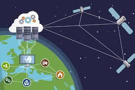
Remote sensing technology involves the acquisition and interpretation of data from a distance, typically using sensors aboard satellites, drones, aircraft, or ground-based platforms. This article explores the fundamentals, applications, technologies, benefits, challenges, and future trends of remote sensing, emphasizing its pivotal role in environmental monitoring, agriculture, disaster management, urban planning, and beyond.
Fundamentals of Remote Sensing
Remote sensing enables the collection of data about the Earth’s surface and atmosphere without direct physical contact. Key principles include:
- Sensors and Platforms: Utilizing sensors that detect electromagnetic radiation across various wavelengths (visible, infrared, microwave) from different platforms (satellites, drones, aircraft, ground-based stations).
- Data Acquisition: Capturing imagery and other data about the Earth’s surface, atmosphere, and oceans to monitor changes, analyze patterns, and extract valuable information.
- Data Interpretation: Processing and analyzing remote sensing data to derive insights, map land use and land cover, monitor environmental changes, and support decision-making.
- Applications: Applying remote sensing in diverse fields such as agriculture, forestry, environmental monitoring, urban planning, disaster management, and climate studies.
Technologies in Remote Sensing
- Satellite Remote Sensing: Orbiting satellites equipped with sensors capture high-resolution imagery and data across large geographical areas, providing global coverage for monitoring environmental changes, weather patterns, and natural disasters.
- Drone (UAV) Remote Sensing: Unmanned aerial vehicles equipped with sensors for precise and localized data collection in agriculture, infrastructure inspection, environmental monitoring, and disaster response.
- LiDAR (Light Detection and Ranging): Using laser pulses to measure distances and create detailed 3D maps of terrain, vegetation structure, and urban landscapes for urban planning, forestry, and archaeological surveys.
- Hyperspectral Imaging: Collecting and analyzing spectral data across hundreds of narrow bands to identify and characterize materials, vegetation types, and environmental parameters with high specificity.
Applications of Remote Sensing
- Environmental Monitoring: Assessing and monitoring changes in land use, deforestation, urban sprawl, water quality, and biodiversity conservation to support sustainable management practices.
- Agriculture and Precision Farming: Monitoring crop health, soil moisture, and nutrient levels to optimize irrigation, fertilization, and pest management for increased productivity and resource efficiency.
- Disaster Management: Rapid assessment and response during natural disasters (floods, wildfires, earthquakes) through real-time monitoring, damage assessment, and planning for emergency relief efforts.
- Urban Planning and Infrastructure: Mapping urban growth, land use, transportation networks, and infrastructure development to support efficient city planning, environmental impact assessment, and resilience to climate change.
Benefits of Remote Sensing
- Global Coverage: Providing extensive spatial coverage and temporal resolution for continuous monitoring and analysis of Earth’s surface and atmosphere.
- Cost-Effectiveness: Offering cost-effective solutions for large-scale data acquisition and monitoring compared to traditional ground-based methods.
- Data Integration: Integrating remote sensing data with GIS (Geographic Information Systems) and other technologies for spatial analysis, modeling, and decision support in diverse applications.
- Scientific Research and Innovation: Facilitating scientific research, climate studies, habitat mapping, and biodiversity conservation through advanced data analytics and interdisciplinary collaborations.
Challenges in Remote Sensing
- Data Quality and Interpretation: Ensuring accuracy, reliability, and consistency of remote sensing data across different sensors, platforms, and atmospheric conditions.
- Technological Advancements: Keeping pace with rapid advancements in sensor technology, data processing algorithms, and integration with emerging technologies (AI, machine learning).
- Privacy and Ethical Considerations: Addressing concerns related to privacy, data ownership, and ethical use of remote sensing data in sensitive or protected areas.
- Policy and Regulatory Frameworks: Establishing international standards, data-sharing protocols, and regulatory frameworks to promote responsible and equitable use of remote sensing technologies.
Future Trends in Remote Sensing
- AI and Machine Learning: Enhancing automated feature extraction, classification, and predictive modeling from remote sensing data for real-time monitoring and decision-making.
- Small Satellite Constellations: Deploying constellations of small satellites for frequent revisits, higher spatial resolution, and enhanced data capture capabilities in remote or underserved regions.
- Climate Change Adaptation: Leveraging remote sensing to monitor and mitigate the impacts of climate change on ecosystems, agriculture, and vulnerable communities.
- Global Collaboration: Fostering international partnerships and data-sharing initiatives to address global challenges and promote sustainable development goals using remote sensing technologies.
Conclusion
Remote sensing technology continues to drive innovation and address complex challenges in environmental monitoring, agriculture, disaster management, urban planning, and scientific research. By leveraging advanced sensors, data analytics, and interdisciplinary approaches, remote sensing plays a crucial role in understanding and managing Earth’s resources, supporting sustainable development, and building resilient communities worldwide. Embracing technological advancements, addressing data quality and ethical concerns, and fostering global cooperation will be essential in harnessing the full potential of remote sensing for a more sustainable and equitable future.